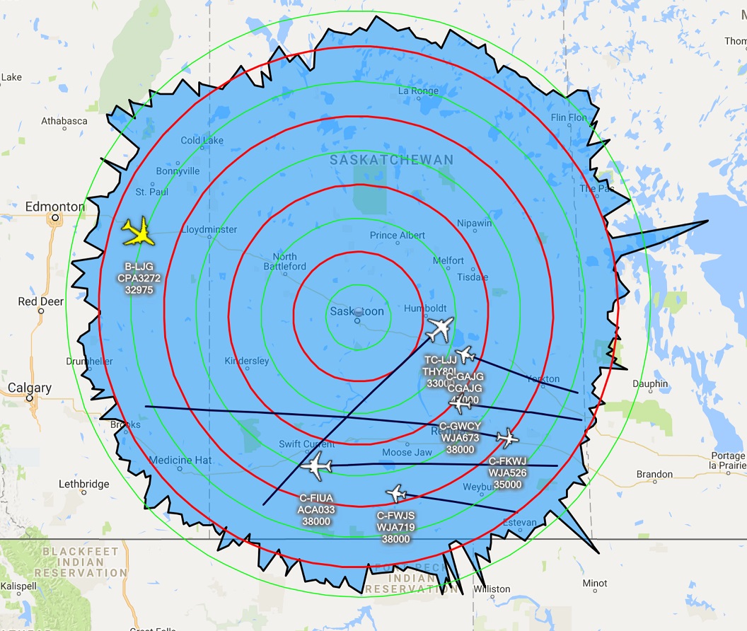
March 2017 Rangeplot
from Planeplotter


(click to enlarge)
and from Virtual Radar Server
(click to enlarge)
At the beginning of March it was time to upgrade some of the software components used to track flights and generate these images. I upgraded Planeplotter and each instance of Dump1090-Mutability. Somehow I messed up the Planeplotter upgrade and not all of the background map tiles loaded, and at the same time, I managed to chop-off the top and bottom of the aircraft trails. With the restart at the beginning of April, the problem seems to be solved.
Spikes on the chart
Sometimes a garbled signal will be received from an aircraft and is decoded with an incorrect position. At other times, an aircraft may have a defect in its transponder that is causing it to occasionally transmit incorrect positions. These will often appear as random single spikes in the monthly chart on Virtual Radar Server, and as much as the software will try to apply some logic and filter them out, some of the false positions remain. Of course, if conditions are 'just right', a perfectly valid spike may appear, however after checking the logs, that large spike into Manitoba does not appear to be a valid one.
No comments:
Post a Comment